
When planning a property purchase, construction project, site improvement, or design review, one of the first questions is often simple: what kind of survey do you need?
Two of the most common survey types are boundary surveys and topographic surveys. They are both important, but they answer different questions. Understanding the difference can help property owners, developers, architects, engineers, contractors, and real estate professionals request the right scope of work from the beginning.
What Is a Boundary Survey?
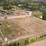
A boundary survey focuses on identifying the legal boundaries of a property. In practical terms, it helps determine where the property lines and corners are located based on records, field evidence, and professional survey analysis.
Boundary surveys are commonly used when someone needs to understand the limits of a parcel, evaluate possible encroachments, plan improvements near a property line, or support a real estate transaction.
A boundary survey may be useful when you are:
- Buying or selling property
- Planning a fence, wall, addition, driveway, or other improvement
- Resolving uncertainty about a property line
- Reviewing easements or possible encroachments
- Dividing, adjusting, or developing land
- Preparing for design, permitting, or construction work near parcel lines
The key question a boundary survey helps answer is: where are the property limits?
What Is a Topographic Survey?
A topographic survey, often called a topo survey, focuses on the physical features and elevations of a site. Rather than concentrating only on property lines, a topographic survey documents existing site conditions that may affect planning, design, engineering, permitting, or construction.
Depending on the project scope, a topographic survey may show features such as:
- Ground elevations and contours
- Buildings and other structures
- Streets, curbs, sidewalks, and driveways
- Trees and visible landscape features
- Retaining walls, fences, and site improvements
- Visible utilities and utility structures
- Drainage features and grade changes
The key question a topographic survey helps answer is: what exists on the site, and how is the land shaped?
Boundary Survey vs. Topographic Survey: The Practical Difference
The easiest way to understand the difference is this:
A boundary survey identifies the property limits.
A topographic survey documents the site conditions and elevations.
If your concern is where the property line is located, a boundary survey is usually the starting point. If your concern is how the site will be designed, graded, engineered, or built, a topographic survey may be needed.
Many projects require both. For example, an architect may need topographic information to begin design, but the project team may also need boundary information to confirm setbacks, easements, or development limits.
When Do You Need a Boundary Survey?
A boundary survey is often important when property ownership, legal limits, or improvements near parcel lines are involved.
Common examples include:
- A homeowner wants to build a fence but is unsure where the property line is located.
- A buyer wants to better understand a parcel before closing on a property.
- A neighbor dispute involves a wall, driveway, tree, or improvement near a shared line.
- A property owner is considering a lot line adjustment or parcel-related change.
- A developer needs to understand parcel limits before planning a project.
Boundary surveys can help reduce uncertainty before decisions are made. They are especially valuable when assumptions about property lines could lead to costly mistakes.
When Do You Need a Topographic Survey?
A topographic survey is often needed before design, engineering, site planning, or construction. Architects, civil engineers, landscape architects, developers, and contractors commonly rely on topo surveys to understand existing conditions.
Common examples include:
- A property owner is planning a new home, addition, ADU, or major remodel.
- An architect needs existing site information before starting design.
- An engineer needs elevations, drainage patterns, and site features for planning.
- A developer is evaluating how a site can be used or improved.
- A contractor needs accurate site information before construction activity begins.
Topographic surveys are particularly important on properties with slope, retaining walls, drainage concerns, complex improvements, or tight development constraints.
Can One Survey Include Both Boundary and Topographic Information?
Yes. In many cases, a survey scope can include both boundary and topographic elements. The right scope depends on the property, the project goals, and what the design, title, permitting, or construction team needs.
For example, a project team planning a new structure may need boundary information to understand parcel limits and topographic information to support design and grading. A commercial property transaction may require a different level of boundary, title, and improvement documentation. A residential improvement may need a more focused scope.
This is why it is helpful to explain the purpose of the survey when requesting a quote. The more clearly the goal is defined, the easier it is to recommend the appropriate survey type.
What Information Should You Provide When Requesting a Survey Quote?
Before requesting a quote, gather as much basic property and project information as possible. Helpful details may include:
- Property address
- Assessor’s Parcel Number, if available
- Type of survey needed, if known
- Reason for the survey
- Project timeline
- Deed, title report, or legal description, if available
- Site plans, architectural plans, or prior surveys, if available
You do not need to know every technical detail before reaching out. If you are unsure whether you need a boundary survey, topographic survey, or both, a professional survey team can help clarify the right starting point.
Choosing the Right Survey for Your Project
The right survey depends on what decision you are trying to make.
If you need to understand property lines, easements, corners, or possible encroachments, a boundary survey may be appropriate.
If you need existing site conditions, elevations, contours, improvements, and physical features for planning or design, a topographic survey may be appropriate.
If your project involves design near property lines, permitting, construction, development, or a real estate transaction, you may need a combined scope.
Talk With Terwilliger About the Right Survey Scope
Terwilliger Land Survey Engineers provides professional land surveying services for property owners, developers, architects, engineers, contractors, real estate professionals, and commercial project teams throughout California.
If you are not sure which type of survey your project requires, start with the property address, project goal, and timeline. Our team can help you determine whether a boundary survey, topographic survey, or combined scope is the right fit.