
Why You May Need a Survey Before Buying or Developing Vacant Land
Vacant land can look simple.
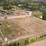
There may be no building, no tenant, and few visible improvements. But from a surveying and development perspective, an undeveloped parcel can raise important questions that are difficult to answer by simply visiting the property or looking at an online map.
Where are the actual property boundaries? How does the site slope? How is the parcel accessed? Are there easements? Are neighboring improvements close to or across a boundary? What information will an architect or engineer need before evaluating development?
A professional land survey can help provide a more reliable picture of the property before major decisions are made.
Online Property Maps Are a Starting Point, Not a Boundary Survey
Online parcel viewers and mapping tools can be useful for general research.
They may help you identify an Assessor’s Parcel Number, approximate parcel shape, surrounding streets, or nearby properties.
They should not automatically be treated as a precise representation of the legal property boundary.
If the exact location of the boundary matters to your purchase or development plan, professional surveying may be appropriate.
Boundary Information Can Affect the Entire Development Concept
A development plan begins with understanding the land available for use.
Property boundaries can affect:
- Building placement
- Setbacks
- Driveways
- Parking
- Walls
- Landscaping
- Access
- Grading
- Utility planning
- Future lot adjustments
If a designer begins with inaccurate assumptions about the parcel limits, those assumptions can carry into later plans.
Establishing appropriate boundary information early can give the project team a better foundation.
Access Deserves Special Attention
A vacant parcel is not necessarily development-ready simply because it appears to connect to a road.
Access may involve questions about:
- Public street frontage
- Private roads
- Access easements
- Shared driveways
- Rights-of-way
- Physical terrain
- Existing gates or improvements
Surveying can help document physical and boundary conditions related to access.
Title documents and legal review may also be necessary to determine the nature and extent of recorded access rights.
Easements May Affect Usable Areas
Recorded easements can influence how portions of a property may be used.
Examples include easements associated with:
- Utilities
- Drainage
- Access
- Roads
- Pipelines
- Other property rights
Depending on the project, a title report and the underlying easement documents may need to be reviewed along with survey information.
The existence of a large parcel does not necessarily mean every part of it is equally available for a proposed improvement.
Topography Can Change the Development Picture
Elevation and terrain are especially important when evaluating vacant land.
A site that appears relatively manageable from a road or aerial photograph may contain significant grade changes.
A topographic survey can document information such as:
- Ground elevations
- Contours
- Slopes
- Existing drainage features
- Walls
- Roads
- Visible utilities
- Site improvements
- Other physical features
Architects and civil engineers may use this information when evaluating grading, drainage, building placement, access, and other design considerations.
Hillside Properties May Require More Detailed Evaluation
California contains many hillside and sloped development areas.
On these properties, topographic conditions can be particularly important.
A steep grade may affect access, retaining structures, drainage, grading, foundation concepts, or the general feasibility of a proposed layout.
Surveying does not replace geotechnical, civil engineering, architectural, environmental, planning, or other professional analysis.
Instead, it can provide site information those professionals use in their work.
Look for Evidence of Neighboring Improvements
Vacant property does not exist in isolation.
Neighboring fences, walls, driveways, landscaping, utilities, or structures may be close to a parcel boundary.
A survey may identify physical conditions that deserve additional review before acquisition or development.
If a potential encroachment or boundary concern is discovered, it is usually better to understand it before design or construction has begun.
Not Every Vacant Parcel Needs the Same Survey
The appropriate survey depends on why the property is being evaluated.
A buyer primarily concerned about boundaries may need a different scope from a developer preparing architectural and engineering plans.
Possible services may include:
- Boundary surveying
- Topographic surveying
- ALTA/NSPS Land Title Surveying for applicable commercial transactions
- Existing-condition mapping
- Easement-related survey work
- Lot line adjustment support
- Development-related surveying
Explain the intended use of the property when requesting a quote.
That allows the surveyor to evaluate the appropriate scope rather than providing a generic survey product.
Surveying Is One Part of Due Diligence
A land survey can answer important spatial and boundary-related questions, but it is only one part of evaluating vacant land.
Depending on the property and intended project, buyers or developers may also need assistance from:
- Architects
- Civil engineers
- Geotechnical consultants
- Environmental consultants
- Planners
- Title professionals
- Attorneys
- Utility providers
- Local agencies
The survey can provide an important base layer of information that helps these professionals evaluate the site.
Order the Survey Early Enough to Use the Information
Timing matters.
If a property transaction includes a due diligence period, consider whether survey information is needed before that period expires.
If development planning has already begun, provide available concept drawings to the surveyor.
Ordering a survey after the design is largely complete can sometimes reveal conditions that require revisions.
Early information gives the project team more flexibility.
What Should You Provide When Requesting a Vacant Land Survey Quote?
Helpful information includes:
- Property address, if one exists
- Assessor’s Parcel Number
- Parcel map or legal description
- Title report, if available
- Purpose of the survey
- Proposed development concept
- Desired survey deliverables
- Access information
- Transaction or design deadlines
- Any known boundary, easement, or access concerns
Vacant parcels sometimes lack normal street addresses, making the APN, legal description, parcel map, or location information particularly important.
Talk With Terwilliger Before Buying or Developing Vacant Land
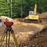
Terwilliger Land Survey Engineers provides professional land surveying services for property acquisition, development, design, due diligence, and construction projects throughout California.
If you are considering a vacant property, share the parcel information, your intended use, available title materials, development plans, and timeline.
Understanding the site early can help you and your project team make decisions using better property information.