
Lot Line Adjustments Explained: Surveying Requirements Before You Change a Property Boundary
Sometimes neighboring property owners want to move the boundary between their parcels without creating an entirely new subdivision.
One property may need additional space for access. A building may sit too close to an existing line. A development plan may work better with a different parcel configuration. Two parcels under common ownership may have boundaries that no longer make practical sense.
A lot line adjustment may provide a way to modify the boundary configuration between existing parcels, subject to applicable local requirements.
Because the process involves the location and description of property boundaries, professional land surveying can play an important role.
What Is a Lot Line Adjustment?
A lot line adjustment changes the location of an existing boundary between adjoining legal parcels.
The objective is generally to reconfigure existing parcels rather than simply create additional parcels.
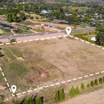
For example, imagine two adjoining properties where one parcel transfers a strip of land to the other. After approval and completion of the required documentation, the boundary between them may follow a new configuration.
The exact procedures and requirements depend on the city, county, project, and properties involved.
Why Might Property Owners Consider a Lot Line Adjustment?
Lot line adjustments can arise for many reasons.
Examples include:
- Improving access
- Reconfiguring an irregular parcel
- Accommodating a proposed development
- Resolving a building or improvement location issue
- Improving usable yard or development area
- Coordinating parcels under common ownership
- Addressing an existing boundary configuration that no longer works for the owners’ plans
A lot line adjustment should not be treated as simply drawing a new line on a map.
The existing parcels, proposed configuration, title information, legal descriptions, local zoning requirements, and other property conditions may all need to be evaluated.
Start With the Existing Boundary
Before a boundary can be adjusted, the existing property configuration must be understood.
A land surveyor may need to review available records and field evidence to determine the relevant existing boundaries.
Depending on the property, this can involve reviewing:
- Deeds
- Legal descriptions
- Recorded parcel maps
- Subdivision maps
- Records of Survey
- Corner records
- Prior surveys
- Easement documents
- Title information
- Existing monuments
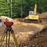
Field surveying may also be necessary to locate or establish the relevant lines and corners.
The Surveyor Helps Define the Proposed Configuration
Once the existing property conditions are understood, the proposed adjusted boundary can be evaluated.
The surveyor may prepare exhibits, legal descriptions, maps, or other documents required as part of the application or recordation process.
The exact documentation depends on the jurisdiction and project.
If an architect, civil engineer, planner, attorney, title company, or developer is involved, coordination may be necessary to make sure everyone is working from the same proposed boundary.
Local Agency Requirements Matter
Lot line adjustment procedures are commonly administered by the city or county with jurisdiction over the property.
Requirements can vary.
Before assuming that a particular boundary configuration can be approved, the project team should review the applicable local process.
The agency may consider issues such as:
- Parcel configuration
- Zoning
- Minimum lot dimensions
- Access
- Existing improvements
- Easements
- Utilities
- Development standards
- Required application exhibits
- Legal descriptions
- Ownership and title documentation
Surveying is one important part of the process, but approval may involve planning, engineering, title, legal, or other considerations as well.
Easements Do Not Necessarily Move With a Property Line
One issue that deserves attention is the relationship between the proposed lot line and existing easements.
A parcel may be affected by easements for:
- Access
- Utilities
- Drainage
- Ingress and egress
- Private roads
- Other recorded rights
Changing a property line does not necessarily eliminate or relocate existing easement rights.
Title information and recorded documents should be reviewed so the project team can understand whether an easement affects the proposed configuration.
Questions involving the legal effect of easement documents should be addressed with the appropriate title or legal professionals.
Existing Buildings Can Affect the Proposed Adjustment
Buildings and other improvements can also influence a lot line adjustment.
A proposed new line might change the relationship between a building and:
- Property boundaries
- Setbacks
- Access areas
- Driveways
- Walls
- Utilities
- Other site features
This is one reason combining accurate boundary information with existing-condition surveying can be helpful.
The proposed line should be evaluated in the context of what is actually on the property.
Provide the Surveyor With Complete Information
When requesting a quote for lot line adjustment surveying, provide as much information as possible.
Helpful materials may include:
- Addresses of all affected parcels
- Assessor’s Parcel Numbers
- Current deeds
- Preliminary title reports
- Existing legal descriptions
- Prior surveys
- Parcel or subdivision maps
- Proposed development plans
- A sketch showing the desired boundary change
- Correspondence from the city or county
- Any available lot line adjustment application requirements
Even a simple sketch showing what the owners hope to accomplish can help the surveyor understand the intended project.
Coordinate Early With All Property Owners
A lot line adjustment generally involves adjoining property interests, so early coordination is important.
The owners should have a common understanding of the intended boundary change before significant surveying, planning, or document preparation begins.
If lenders, trusts, corporations, LLCs, or other ownership entities are involved, additional documentation or approvals may also be necessary.
Title and legal professionals can help address ownership, transfer, and recordation questions outside the surveyor’s role.
Survey First, Design With Better Information
If the lot line adjustment is related to a future building or development project, it can be useful to address the boundary configuration early.
Designing a project around an assumed future property line can lead to revisions if the proposed adjustment changes.
Surveying and agency coordination early in the process can give architects, engineers, developers, and owners better information for subsequent planning.
Talk With Terwilliger About a Lot Line Adjustment
Terwilliger Land Survey Engineers provides professional surveying services for property owners, developers, architects, engineers, and project teams throughout California.
If you are considering changing the boundary between adjoining parcels, provide the affected property addresses, APNs, available title or deed information, any prior surveys, and a description or sketch of the proposed adjustment.
The survey team can review the surveying component of the project and help identify the information needed to move forward.